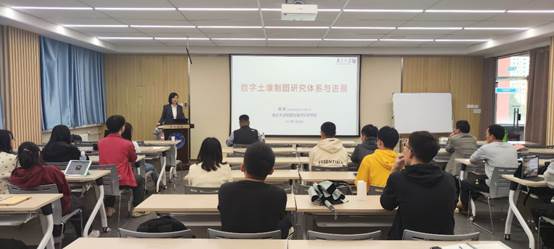
At the invitation of the Department of Geography, College of Earth and Environmental Sciences, Lanzhou University, Professor Yang Lin from Nanjing University came to our school for academic exchange on September 24. On the afternoon of September 24, Professor Yang Lin made an academic report on the research System and Progress of Digital soil Mapping in Qilian Hall 502 Conference room, Chengguan Campus, and discussed the importance of soil spatial distribution information and the third National soil census. The report was chaired by Professor Geng Haopeng of the College of Earth and Environmental Sciences. Some teachers, graduate students and undergraduates of the Department of Geography of the College of Earth and Environmental Sciences listened to the report.
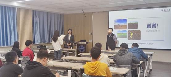
Professor Yang Lin elaborated on soil spatial distribution mapping from three aspects: representative sampling method, environmental covariate acquisition and spatial inference model. First of all, the common sampling techniques, multi-grade representative sampling techniques and common environmental covariate data are introduced, and two cases are used to explain the utility of new environmental variables and soil moisture variables. In the part of explaining spatial reasoning model, Professor Yang Lin introduced the role of machine learning and deep learning in digital soil mapping and model construction. Then, Professor Yang Lin showed the prediction method of soil spatio-temporal change used by her team, as well as the new method of fusion process mechanism and machine learning for the change of soil properties. Finally, the teachers and students present had a passionate discussion with Professor Yang Lin about their own research direction, and said that they benefited a lot from the academic report, gained a lot of inspiration and inspiration, which is helpful to carry out future academic research.
Expert Profile:
Yang Lin, professor and doctoral supervisor at the School of Geography and Marine Science, Nanjing University, was selected as a top young talent in the national "10,000 Thousand Program", mainly engaged in the spatio-temporal simulation of surface elements and their driving research. Published 100 academic papers, In Science Advances, ISPRS-J, IJGIS, Geoderma, Catena, Environmental Research Letters, Environmental Pollution and other famous journals published one work/general SCI papers 40. He presided over 3 National Natural Science Foundation projects, 1 National 863 theme project sub-project, and 1 national key research and development plan project sub-project. He was elected vice president of the Soil Metrology Society of the International Union of Soil Science in 2014, and is currently a member of the Award committee of the International Society of Soil Metrology, deputy chairman of the Resource Mapping Committee of the Chinese Society of Natural Resources, technical expert of the East Asian node of the Global Digital Soil Mapping Program, and technical guidance expert of the third National Soil Census. He served as the editorial board member of SCI journal Geoderma, the editorial board member of Geographical Science and the deputy editor of Frontier in Soil Science, the Pedometrics section. He has won the "Excellent Teaching Achievement Award" of University GIS Forum, the Special Prize of National University GIS Teaching Achievement, the Young Outstanding Paper Award of the Academic Annual Meeting of the Geographical Society of China, the Annual Excellent Paper Award of the Journal of Soil Science, the "Advanced Teacher Ethics" Young Teacher Award of Nanjing University, the Female figure of surveying and mapping Geographic Information Innovation, and the University GIS Innovation Personality Award.
